LiDAR 3D scanning production lines weighted
LiDAR scan before installation of robot The robot can fit the task, but there is
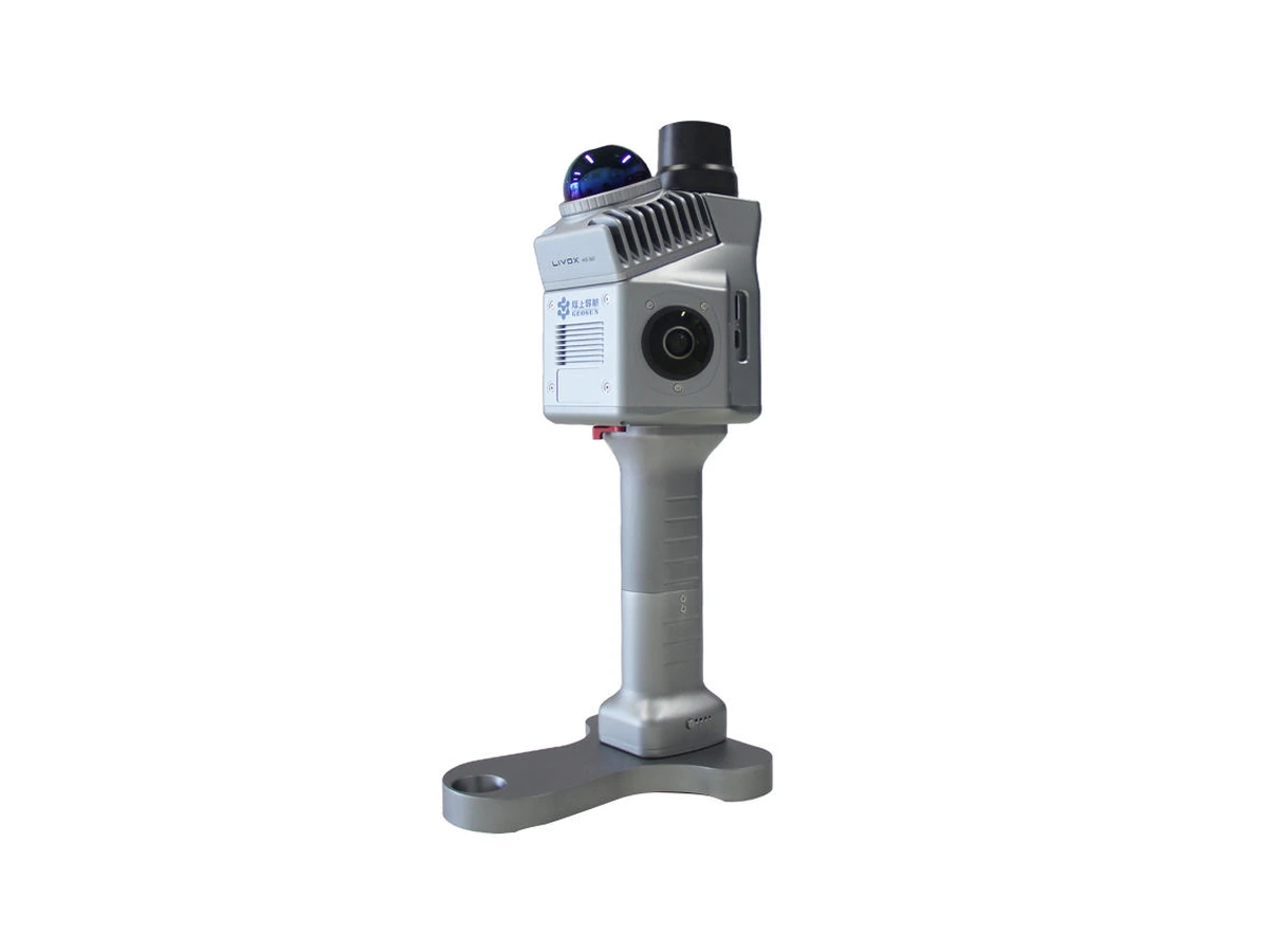
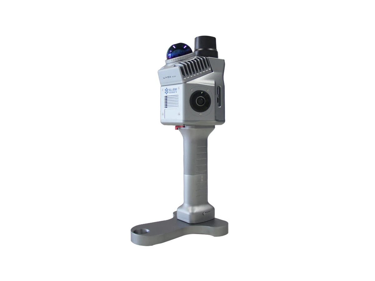
Product details
Specifications
- Title: LiDAR 3D scanning production lines weighted
- Stocks: In stock
Description
LiDAR scan before installation of robot
The robot can fit the task, but there is still no place for it on the existing line. The problem is not always reach. It can be the open door of the machine, service access, support column or the path through which the employees bring the material. So when designing robotics, let's first check the real situation, not just the old floor plan.
With the company Svet Črnil offer LiDAR 3D scanning production lines as a spatial basis for design and faster implementation of the robot. We use laser capture to document the agreed access areas. The scope of processing, the required accuracy and the format of the data transfer are harmonised before implementation. So you know in advance what you order and for which project decision you will use the data.
Shown price 1 € with VAT is the unit of account of weighted service, not the price of total scanning. The final number of units and total amount are confirmed according to the agreed volume. The service also does not mean buying or hiring a scanner.
3D production line coverage
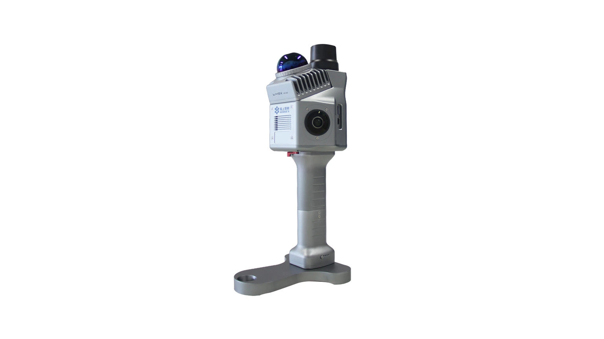
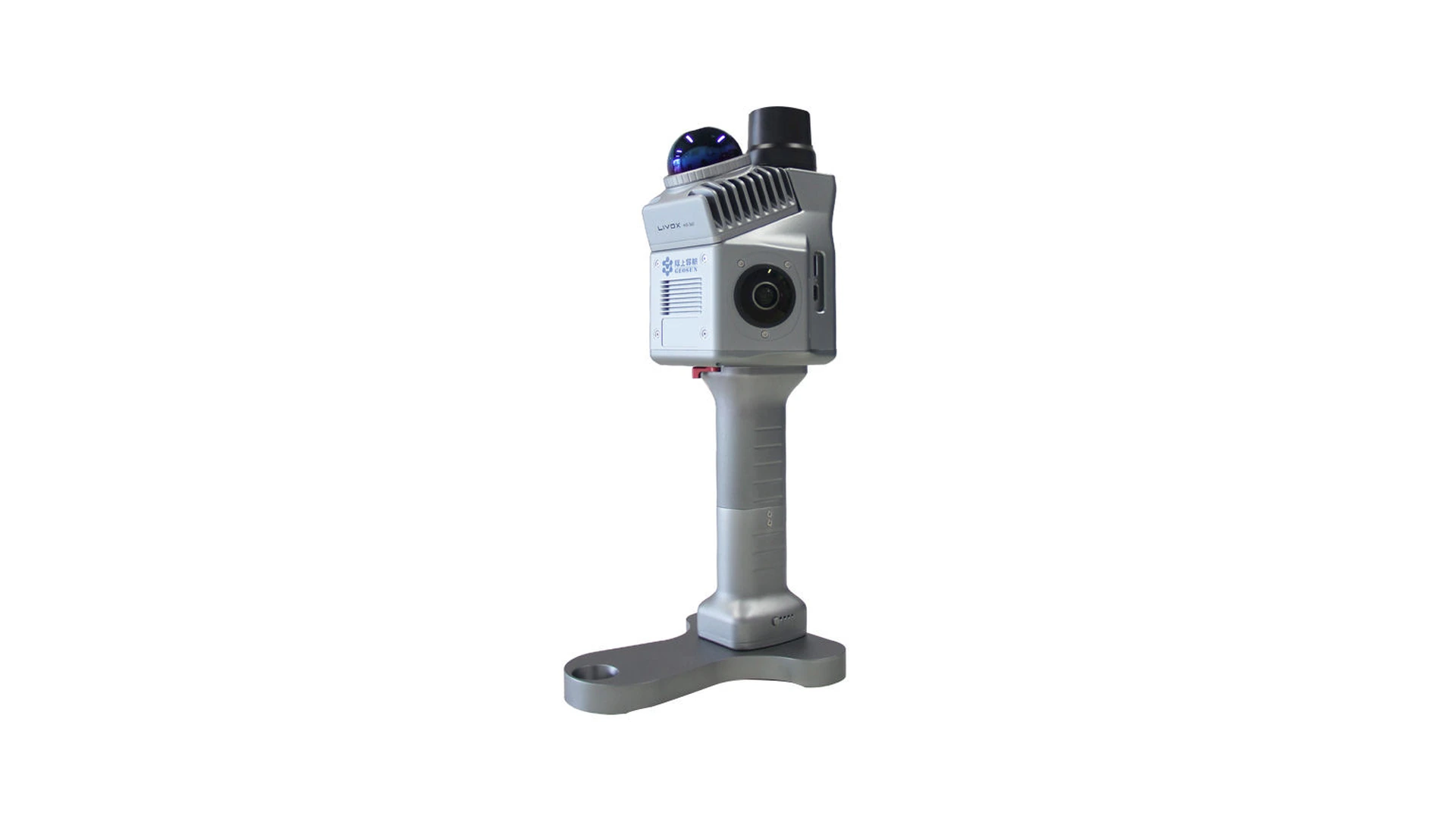
LiDAR is a method of measuring with laser light. The result of spatial coverage can be a cloud of points: a multitude of measured positions describing the visible surfaces of space and equipment. The photo helps to understand the appearance and the spatial capture allows an overview of the distribution in three dimensions. The cloud of points is not an automatic design model or robot program. [1]
In planning we are particularly interested in what data will enable. Need a look around one machine? You're checking out a new paletiz city? Do you want to connect multiple devices to a transporter? The answer shall specify the area of capture and the necessary treatment. It makes no sense to order the largest possible scan if you need a clearly documented smaller part of the production to make a decision.
Autodesk describes the use of existing conditions as a spatial reference when designing factories. Their approach combines data on the actual object with the planned installation, instead of addressing the new elements without any connection to the surrounding area. This is a professional starting point, not a promise of a certain result in each project. [2]
Robotisation for smaller manufacturing companies
The service is particularly sensible for owners of small and medium-sized production companies, production managers, maintenance workers and integrators who update the existing line. You often have equipment and limited space. You're not looking for a new factory, you're looking for a way to upgrade the existing process without unnecessary intervention.
In conversation, let us first determine the problem. Do you want to reduce manual product shifting, edit feed pieces or check the space for the robotic cell? The scan is as useful as it helps to answer such a specific question. We therefore consider it as part of the preparation for the project, not as an independent objective.
- Preparation of the spatial basis for robot service of an existing machine.
- Inspection of packaging, disposal or palletisation area.
- Documentation of transporters and position of adjacent equipment.
- Coordination of layout between client, designer and integrator.
- Inspection of space before moving or extending production line.
What do we include in the scope of the scan
Before visiting, we propose a list of elements that are relevant to your project: machinery, work tables, fences, pillars, walls, transport routes and accessible infrastructure. The contracting authority shall also indicate areas not to be covered as well as restrictions on movement and photographing. This reduces the possibility of missing a key position or of capturing unnecessary data.
Specially distinguish the current visual status from the required workspace. Closed machinery doors do not show the space you need to open them. The position of the pallet on the day coverage does not describe all possible routes of material. Therefore, we add agreed information on use to spatial data and indicate which positions should be checked further.
When preparing, we suggest that you also indicate the location where you want to connect the new device, the intended product, the basic requirements of grasping and available drawings. This information helps to identify the following project steps. The scan itself does not measure the production rate and does not determine the appropriate grip.
From Cloud Points to Robotic Cell
Capture, data cleaning, modelling, simulation and programming are different tasks. You can connect them to a wider project, but we do not assume their inclusion. Autodesk separates capture, project preparation and further data organisation in the documentation; the data captured then serve as a reference in other programs. [3]
Before ordering, we therefore determine whether you want the agreed cloud of points, spatial overview, simplified geometry of the selected elements or also further planning. When a editing CAD model is needed, it is necessary to specify the elements and details to be contained. Only then can you compare tenders with the same expected result.
In addition to space, robot, tool, piece and process data are needed to design the robot. The result of the scan shall not replace the technical assessment of the integrator, the safety treatment of the cell or the verification of the actual execution. Our goal is a useful spatial basis for these steps, not a leap in their examination.
Precision is determined according to the task
Several points on the screen do not yet prove that each dimension is accurate enough to produce. Before we capture, let us agree which dimensions are important, what deviations are acceptable for the project and how critical sites will be checked. An overview of the entire line and the construction of a tightly compatible carrier are different tasks.
The surface visibility must also be taken into account in the preparation. The section for a closed cabinet or under an inaccessible assembly does not become measured solely because the remaining space appears to be complete. Volatile surfaces and glass may require further assessment of data; Autodesk also describes the filtering of unwanted reflections when processing scans. [4]
For important mountings, padlocks or other critical dimensions, we recommend a separate agreement on appropriate control measurement. We do not state universal millimetre precision for the whole service, because without concrete scope, method and verification, such a promise would not be fair.
LiDAR, manual measurement or old plans
The best solution is not always the largest. For a simple task, there can be enough verified measurements. However, when you need to understand the position of several machines and the limitations in space, it makes sense to compare more comprehensive coverage. Below we compare approaches, not unverified prices or the quality of other operators.
| Accession | When Used | What to check |
|---|---|---|
| LiDAR 3D capture | Spatial reference of the existing line and its surroundings. | Scope, visibility, data quality and agreed form of transfer. |
| Manual measurement | A small number of clearly defined measurements or critical site control. | Whether all the dimensions the designer needs are selected. |
| Existing drawings | Understanding the original design and preparing the starting point for the project. | Whether the drawings still correspond to the actual layout and subsequent modifications. |
| Photos and video | Interpretation of process, appearance of equipment and organisation of work. | Whether a decision is sufficient without verified spatial dimensions. |
| Comprehensive modelling and simulation | Detailed verification of the planned solution by agreement. | Which models, process data and additional tasks are included. |
In practice, we propose a combination where it makes sense: existing drawings for understanding the machine, spatial capture for surroundings and control measurements for decisive dimensions. Thus you do not pay for the wrong type of data, but at the same time you do not build the project on missing information.
Weighted price and clear calculation
The unit of account for the service is 1,00 € with VAT. The number of units is determined by agreement according to the capture and the work included. The price is not automatically linked to an hour, square meter or one visit. These meanings are not defined by the unit shown.
The offer must clearly identify the location, coverage area, data transfer and related tasks. Separately coordinate any additional modelling, re-visiting or other project requirements. The amount is only applicable together with the volume.
Illustration of account, not offer: if they had agreed on a certain volume of 350 units of account at €1,00 with VAT, the total amount would have been €350,00 with VAT. The example does not specify the price of your line, duration of coverage or included additional services.
Cheaper from less repeated work
The savings are not just the difference between the two rates of scanning. In the assessment, we suggest that you also take into account the timing of coordination, possible re-visits and the cost of changing the work already done. A favourable contract is the one that provides information for the right decision, not the lowest amount without a defined result.
Benjamin Franklin wrote in 1748 a thought summed up in Slovene as Time is money. [5] For a production project we understand it very practically: timely verified information can be more valuable than a quick start on the wrong basis. The actual savings will depend on your project, so we do not promise percentages or universal execution time.
Before you start, you can write down which remeasurement or reprocessing you want to prevent. After the project, compare the plan and the actual results. So you judge whether the solution was cheaper, based on your data.
Example of planning an existing line
Illustration example of use, not statement or reference of actual customer: a smaller manufacturer wants to add robotic deposition along the packing line. There's plenty of room on the floor plan, but the team wants to check the service doors and pallets before ordering equipment.
The proposed procedure is to first define the coverage area, relevant positions and information on the envisaged cell. It then compares the spatial basis with the layout plan. The control measures and the final solution shall be confirmed in further technical consideration. The expected benefit is a common understanding of space between production, maintenance and integrator, not an automatic confirmation of robot operation.
Such an example shows what is a good result for the customer: not just a file, but a clearer decision. When preparing a similar project, we suggest that you determine in advance which decisions must be made by the spatial basis and who will check the selected implementation.
Digital record before space change
Euronews is 18. april 2019 reported that the previous laser capture of Notre-Dame could help to restore it. [6] The example shows the importance of the preserved spatial documentation before the object change. It does not prove the accuracy of our service or results in industrial robotics.
For your production, the practical question is similar: will you still have a useful record of your previous condition after moving the machine? We suggest that you save the date, scope, coordinate agreement used and data version at the time of transfer. So you don't replace the old layout with the new one later.
Thoughtful planning can help to preserve useful equipment and prevent some unnecessary processing. This is a possible environmental benefit, not measured waste reduction for each project. Here, too, we distinguish the expected impact from the result that needs to be verified.
LiDAR scanning Ljubljana and demand
Our starting point is Ljubljana. If you want to coordinate preparation locally, first send us a basic description of the line and desired changes. For other locations we specifically arrange the execution. With the company Svet Črnil help you clarify which spatial data will be really useful for your next step.
- Location and approximate range of area you want to capture.
- Photos or sketches of existing layouts that may be shared.
- The task of the intended robot and the equipment remaining in place.
- Important dimensions, access, service doors and limitations cover.
- Program(s) to use the data.
- The desired term, form of surrender and expected result.
Send project description and prepare coverage! Period, included tasks, number of units of account and final amount are adjusted before implementation. We do not promise a universal deadline, because without knowing your line it cannot be determined responsibly.
Resources for 3D capture and planning
[1] Autodesk: Point Clouds. https://www.autodesk.com/solutions/point-clouds
[2] Autodesk: Factory Design. https://www.autodesk.com/solutions/factory-design
[3] Autodesk: About the Reality Capture Process. https://help.autodesk.com/cloudhelp/ENU/Reality-Capture/files/Getting_Started/about_reality_capture.html
[4] Autodesk: Set up and configuration a new ReCap project. https://www.autodesk.com/learn/ondemand/curated/recap-pro-quick-start-guide/vJvQLbUBsxPqC1v9giZNK
[5] Benjamin Franklin: Advice to a Young Tradesman, July 21, 1748, published at Cambridge University Press. English translation of short thoughts.
[6] Euronews, 18. april 2019: Unique 3D model of Notre Dame catedral could help reconstruction effects. https://www.euronews.com/2019/04/18/unique-3d-model-of-notre-dame-cathedral-could-help-reconstruction-efforts
Is it really cheaper to order a robotic cell based on an unverified layout than before to check the space in which it will have to operate?
Documentation

Preparation of the production line for LiDAR scanning
Prepare a line for a usable 3D capture: range, access, critical dimensions, term and data for the robotic cell designer.
Preview / Download
From LiDAR Cloud Points to Robotic Cell Plan
The difference between a cloud of points, a CAD model and a robotic simulation. Check data transfer, critical dimensions and scope of further work.
Preview / Download
LiDAR service: volume, surrender and weighted price
What is the unit of account of € 1 and what must the LiDAR capture arrangement contain? Clear surrender, service boundaries and checklist.
Preview / DownloadAdvantages
Prostorska podlaga
3D zajem obstoječe linije za pripravo robotizacije.
Dogovorjen obseg in predaja
1 € je obračunska enota; končno ceno uskladimo pred izvedbo.
Frequently Asked Questions

What to send for LiDAR scan offer?
Send location, description of the line, photos, purpose of capture, critical measures and desired surrender. Then we reconcile the volume and price.
Which files do I receive after LiDAR scan?
The form of surrender is agreed before capture according to your program. Let's check the files, the units, the baseline and the agreed range.

How accurate is LiDAR to capture the production line?
Precision is harmonised according to the task and check critical locations. The density of points alone does not guarantee the correctness of all dimensions.
Do I get a CAD model and robot program with a LiDAR scan?
Not automatically. Cloud points, CAD model, simulation and programming are different tasks; inclusion is determined in agreement.

Is it necessary to stop production after LiDAR capture?
This is determined by area and coverage conditions. Before the term, we coordinate the access, condition of the equipment and possible rest.
Does LiDAR scan the entire line cost €1?
No. € 1 with VAT is the weighted service unit of account. Volume, number of units and final price are agreed before implementation.


Can I make money selling your products?
Join our sales network and earn up to 35%! You don’t need a company to start – we support you on the way to success and extra earnings.

What should I use instead of Anydesk or Teamviewer?
Discover RustDesk, a free and open source alternative to AnyDesk and TeamViewer that allows easy and safe remote access without restrictions.

Are you authorized to serve any brand?
Discover the advantages and disadvantages of independent service and how our experience and flexible approach can help you repair your device.
Recommended products
Ni priporočenih izdelkov.